Director of Surveying, Neil Chance, considers how technology is changing the nature of surveying – but he is keen to point out that the industry has not been entirely taken over by robots, and that smart, intelligent people will always be required ‘with boots on the ground’.
Just as in many other professional services, the role of the land surveyor has evolved massively over the past few years thanks to advances in technology. What used to be a long and painstaking process can now be completed in a fraction of the time thanks to technological advances such as Global Positioning Systems (GPS), laser scanning and drone technology.
As these technologies progress from cutting edge to commonplace they will have an effect on the way developers and construction companies obtain the surveys they need to deliver successful developments. An understanding of the available technology will however always be required in order to deliver any survey ‘fit for purpose’.
GPS
Using GPS we are able to take accurate measurements over large areas of open land. What used to take a whole team many hours to accomplish can now be completed in half the time by a single surveyor. It should be stressed however that GPS needs a ‘wide window to the sky’ so will not function accurately adjacent to buildings, below tree canopies, under bridges, etc.
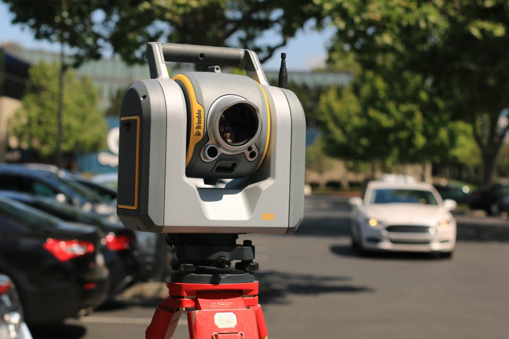
Robotic total stations
Robotic total stations (now commonly found in the boot of most surveyors’ cars) also allow the surveyor to complete much of a survey without another colleague’s help, however, once again there will be more ‘obscure parts’ which frequently require an extra pair of hands. For this reason most surveyors are still dispatched to site as a team of two, usually with two robotic total stations. The innumerable advantages include not just successful completion of the entire survey but also allow operations such as lifting the manhole covers to be completed.
These two survey methods produce clean and specific ‘point, line and level’ information; the surveyor shows all the detail necessary presented in a clear, familiar and unambiguous way.
In contrast to these methods, laser scanning in all its various forms is now well known – but arguably little understood. For general development surveying purposes, scanning can be split into 3 types, LiDAR, Structural scanning and Drone scanning.
LiDAR
LiDAR (Light Detection and Ranging) is very similar to Radar, carried out from an aerial platform such as a drone or plane. As an advance on radar it can utilise different wavelengths of light, therefore providing more intelligence on whatever surface is reflecting that light. LiDAR data is usually purchased by its density, so a Hectare of information including data points at 10m separations costs considerably less than the same Hectare covered at 10cm intervals. Care needs to be taken when evaluating the data; a densely packed container park’s levels might be consistently flat but will the levels be ground level or container tops?
Structural scanning
This is usually completed from a tripod-based piece of hardware. Millions of points are scanned using laser technology, the automated process can involve just a few minutes at each ‘set up’. Obviously a clear ‘line of sight’ is required between any set up position and any point to be surveyed but the advantage over traditional tripod based methods is that there’s no need to get physically close to the required point of interest. Using many set up positions with a great overlap and duplication of the scanned areas means entire buildings can be scanned both inside and outside. A vast amount of data is collected.
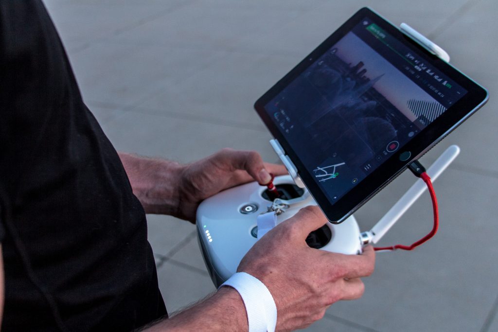
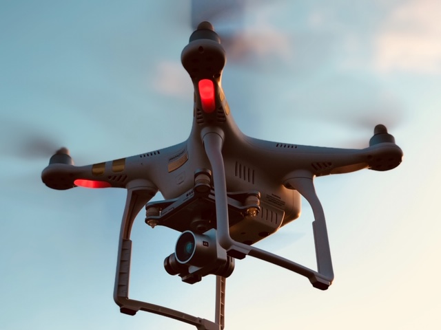
Drone scanning
Similar to the above but carried out from an aerial platform. In half an hour a drone might easily capture sufficient information to model a complete quarry. The view ‘from above’ does not have to be vertical, and oblique angles of view can be used to capture ‘neighbouring information’ with photography if required. Once again vast amounts of data are obtained, but increasing regulation of the industry imposes additional restraints on the use of drones.
These three methods can all produce ‘point cloud’ information; the processing time and the power required to access that information in a simple intelligible way is significant. The information from a half hour drone flight might take ‘overnight’ to download and process into useable data. Most clients and consultants will have no use for the overwhelming amounts of data captured through scanning but will require the intelligent interpretation of those point clouds to be presented in the more useable formats of 2D or 3D CAD-based plans.
So, how to choose ‘which surveyor’? The answer is to choose a company that understands both ‘what technology is available and what the client will need’.
Here are a couple of examples of our recent projects demonstrating all these technologies and satisfying the clients’ varying requirements.
Our first client’s site included both a substantial leisure centre and a major league football club ground, surrounded by development on all sides ranging from modern 5 storey flats to pre-war bungalows. The Planning Authority required sections and visualisations of the proposed development from the adjacent dwellings, however substantial existing landscaping in their rear gardens and around the site obscured most of the necessary details. We employed traditional tripod based survey methods to complete the major topographic survey, GPS methods to fix the site to the Ordnance Survey National Grid, laser scanning of the opposing blocks of flats and finally drone flights to obliquely obtain the adjacent property details without having to overfly those ‘reluctant’ neighbours. The results – quick, accurate, complete data, giving our clients the precision and confidence required to move their development plans to the next stage.
The second client’s site lay on the edge of an existing village and came with a topographic survey provided by the vendor. Unfortunately this did not include the required one kilometre survey of the off-site pumping main route. It ran alongside the adjacent bypass and then crossed below the M40 motorway before traversing open countryside to the proposed outfall. We employed traditional tripod-based survey methods to complete the bypass areas but were only able to obtain limited laser measurements remotely onto the M40 motorway surface due to its location in a deep cutting with overgrown embankments. We used these measurements to check some purchased LiDAR data at the appropriate intervals, enabling us to incorporate that verified data into the survey. The open countryside survey was completed using GPS and the two surveys were combined into one seamless model for the client.
As part of a multidisciplinary practice, our experienced Surveying team has the understanding of the needs of both the clients and other consultants. We can help specify the brief for these surveys using all the available technologies. Fortunately our industry has not been entirely taken over by robots and smart, intelligent people will always be required ‘with boots on the ground’. A lightweight drone is never going to notice that the strange shape under the hedge canopy is a manhole cover nor will it help you to lift it!
To discuss your surveying requirements, get in touch with Neil Chance.